
Sandleford Park East development: Archaeologists to begin digging trenches ahead of Newbury 1,000 home development

Archaeologists will soon be digging trenches ahead of the development of around a thousand homes at Sandleford Park East in Newbury.
Around 109 trenches will be dug at the site once the developers Bloor Homes appoints an archaeology team.
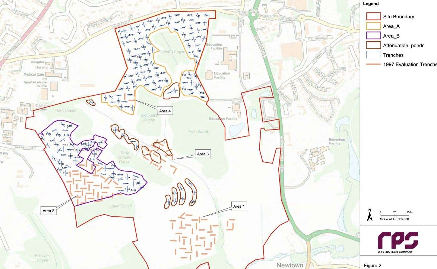
West Berkshire Council’s district archaeologist has approved the dig plan submitted by the developer’s heritage consultants RPS, involving digging 30m x 2m trenches across the site.
There have been previous investigations on the land, which used to house an Augustinian Priory, is on the fringes of the 1643 First Battle of Newbury, and next to a deserted town.
The site is said to have prehistoric, Roman and medieval remains.
A field walking exercise in 1997 recovered 57 pieces of struck flint, including a possible Palaeolithic flint flake, three blades or flakes of Mesolithic or early Neolithic date, and one transverse arrowhead of late Neolithic/early Bronze Age date.
A concentration of struck flint was recorded on the lower ground either side of the stream channel in the south-east of the site.
Subsequently, an archaeological evaluation was undertaken comprising a total of 113 trenches focussed in four areas of the site.
Further investigations on the west of the site showed the presence of Romano-British metalwork and a number of Romano-British features interpreted as field systems.
Other Palaeolithic evidence in the area comprises hand axes recovered from a quarry near Sandpit Hill.
The archaeology background report indicates prehistoric activity across the wider landscape.
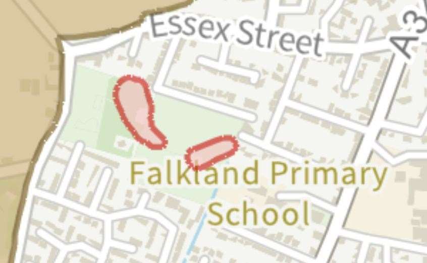
It says a Neolithic scraper was found in Newtown Road, a Neolithic flint axe was recorded from near the Falkland Memorial, and a polished flint axehead was found on Monks Lane close to the northern boundary of the site.
A Neolithic/Bronze Age barrow cemetery, designated as two scheduled monuments, comprising a Bronze Age barrow and two bowl barrows, and are nearby to the west of the study site at Wash Common.
There are five elements to the Wash Common barrow cemetery, including four bowl barrows and a disc barrow (also described as a hengi-form monument, although its ditch is external).
They are located between the Kennet and Enborne valleys.
The study site lies remote from the main Roman road from Silchester to Cirencester, which crosses the River Kennet near Thatcham.
Stray finds, metal detecting finds and more systematic archaeological fieldwork evidences the clearance, settlement and farming of the landscape across the Kennet/Enborne watershed.
In particular, an Iron Age gold coin is recorded from Gorse Covert, an area of woodland in the south-west of the site.
Roman steelyard weights were recovered by metal detectors in the south-west of the site, and a possible Roman V-shaped boundary ditch was recorded during an archaeological evaluation on Tydehams Gardens.
The Domesday Survey of 1086 records that the greater part of Sandleford parish was included in the manor of Ulvritone.
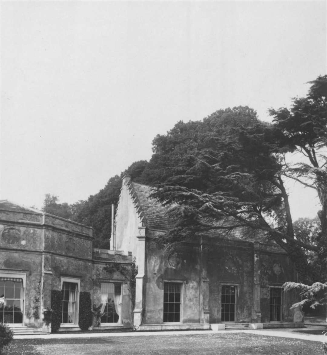
The Augustinian Priory at Sandleford was founded between 1193 and 1202 on a site which already supported a religious settlement.
During the Medieval period, the site lay remote from the growing urban market centre at Newbury and in a landscape of scattered villages and farmsteads.
The Priory at Sandleford was closed in 1478 and its estate was transferred to the Dean and Chapter of St George’s Chapel, Windsor, after which the former priory buildings were used by a series of tenants.
The report also points out that a deserted medieval town of Newtown is located 300m south-east of the site.
It says the medieval borough of Newtown was created by the Bishop of Winchester in the year 1218. Early documents record the place-name as Nova Villa, (Latin for Newtown) or Novo Burgo de Clere, or Nova Villa de Sandleford.
The latter reference is to Sandleford Priory, which had been established some 20 years earlier. Sixty-seven building plots lined the street. No traces of the medieval borough are now visible above ground.
During the early medieval period the study site lay north-west of the town of Newtown within farmland to the west of Sandleford Priory.
The parcels of woodland currently in the study site are likely to have remained consistent features of a farmed landscape since time of the Augustinian priory.
The borough of Newtown had begun to decay by the 16th century. The growth of the nearby town of Newbury may have reduced trade in Newtown.
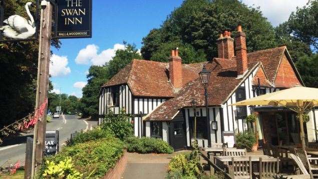
The only remaining houses on original street plots are The Swan and Deepnell House, and possibly The Old Nursery.
It is likely that any other houses, still there at the time, were demolished in the 18th century when Newtown House was built.
The 1761 Rocque Map shows the site occupying arable fields and parcels of woodland bounded by ‘Monkey Lane’ to the north, ‘Newtown Lane’ to the east, the River Enborne to the south and by an uncultivated area marked as ‘Newbury Marsh’ to the west.
The house and grounds of ‘Sandleford House and Chapel’ are shown to the east of the site, and the town of ‘Newtown’ is shown to the south-east of the site.
Part of the dig plan relates to the discovery of any human remains, which must be left in situ, covered and protected.
The discovery of human remains will be reported to the local coroner.
Other structured or placed deposits will be recorded and retained as “small finds”.
Should sufficient human bone be exposed to warrant specialist examination in situ, a human bone specialist may be required to attend to examine the remains.
The site is thought to be located on the fringes of the 1643 First Battle of Newbury fought during the English Civil War.
Therefore, the topsoil and subsoil arising from the trench evaluation will be scanned by metal detector for the recovery of potential metal artefacts related to this battle.
Any remains classified as ‘treasure’ under the Treasure Act 1996 will be removed to a secure location, and where removal cannot be undertaken on the same day as discovery, suitable security measures will be put in place to protect the finds from theft.
Following completion of the fieldwork, there will be a public lecture detailing the results of the fieldwork, given by a local historical or archaeological society.