
Flood alerts in place in Newbury and Lambourn Valley

According to the Environment Agency (EA), a flood alert has been issued for the River Kennet and its tributaries, from Berwick Bassett to Newbury, including: Winterbourne, Monkton, Marlborough, Ramsbury, Hungerford, Denford, Kintbury and Newbury.
Also affected are the River Og, the Froxfield Stream, the River Dun and River Shalbourne.
A flood alert is also in force in respect of groundwater flooding in the Lambourn Valley catchment, with communities at risk of groundwater flooding in the Lambourn Valley.
Villagers in Bagnor have received a flood warning for the next 24 to 72 hours, after the EA called Speen Parish Council and word was spread around the village.
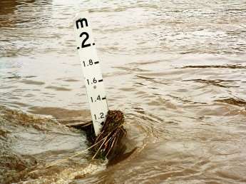
It is believed there has not been any flood warnings in Bagnor before but the river level is exceptionally high and villagers have been advised to take steps to protect their property.
A flood alert is also in place on the River Enborne and Foudry Brook, affecting the River Enborne from Gore End down to Aldermaston, including Ecchinswell Brook, Kingsclere Brook and Foudry Brook and tributaries from Scotsman’s Green to Green Park, including Stratfield Mortimer and Tadley on the Bishopswood Stream.
A flood alert is in place on the River Pang, from East Ilsley to Pangbourne and Sulham Brook, including Compton, Hampstead Norreys, Frilsham, Bucklebury, Stanford Dingley Bradfield and Tidmarsh, affecting Sulham Brook from Theale to Pangbourne including Sulham.
Peter Quarmby, Environment Agency Flood and Coastal Risk Manager, said: “We are warning motorists not to drive through floodwater, it is very dangerous. We have had already seen more than 20mm of rain overnight and we’re expecting further intense rainfall in many areas later today, particularly across Hampshire, Sussex, Isle of Wight, Oxfordshire, Berkshire, Surrey, London and parts of Wiltshire.
“Now is a good time for anyone who lives in an area vulnerable to flooding to think about the precautions they can take to protect their properties, and I would encourage everybody to check their flood risk at the Environment Agency website and keep up to date on warnings.”
Groundwater levels are currently high in parts of Hampshire and Berkshire, and rising in places, with the EA monitoring further rainfall levels. Unsettled weather is forecast over the weekend and in the run up to Christmas.
For more information about flooding and to sign up for free of charge flood warnings, visit the Environment Agency’s website: www.environment-agency.gov.uk, or telephone the Floodline 0845 988 1188
Anyone who has been affected by flooding, or has photographs, please email newsdesk@newburytoday.co.uk
UPDATE - 12.15PM
Police have closed Deans Copse Road which runs between Burghfield and Theale due to floodwater. Drivers should find an alternative route.
West Berkshire Council is advising drivers to avoid the B4009 from Shaw to Hermitage due to floodwater, although it is passable with extreme care at present. Drivers should instead use the A34.