
Newbury woman shares secret map of RAF Greenham Common in 1945

A Newbury woman has shared a fascinating map of Greenham Common in the Second World War.
About 20 years ago, Newbury resident Liz Chaplain was given a map – marked ‘secret’ – by a volunteer at West Berkshire Museum.
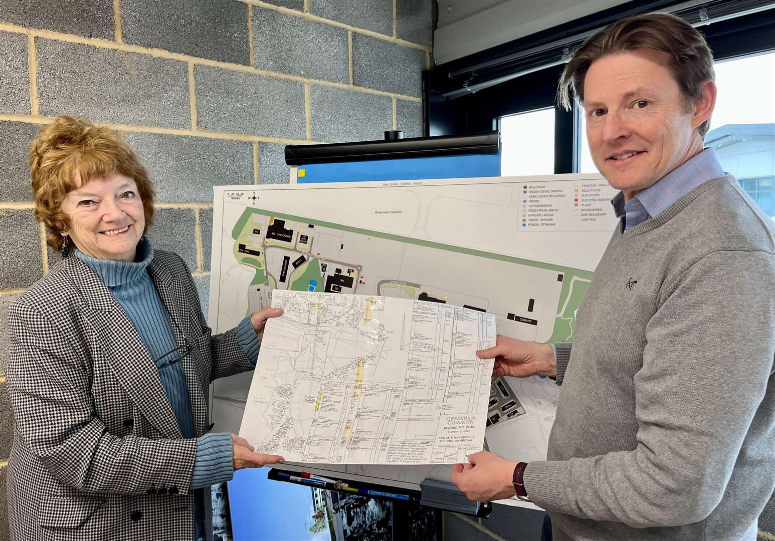
The ‘record site plan’, made by the Air Ministry, shows the distribution of military sites around the former RAF airfield at Greenham Common in March 1945 – plotting everything from troop dining rooms to latrine blocks.
Mrs Chaplain lived at Beechwood Cottage from around 1986 until 2010, “right bang in the middle” of the military infrastructure, which was located north of the base, she says.
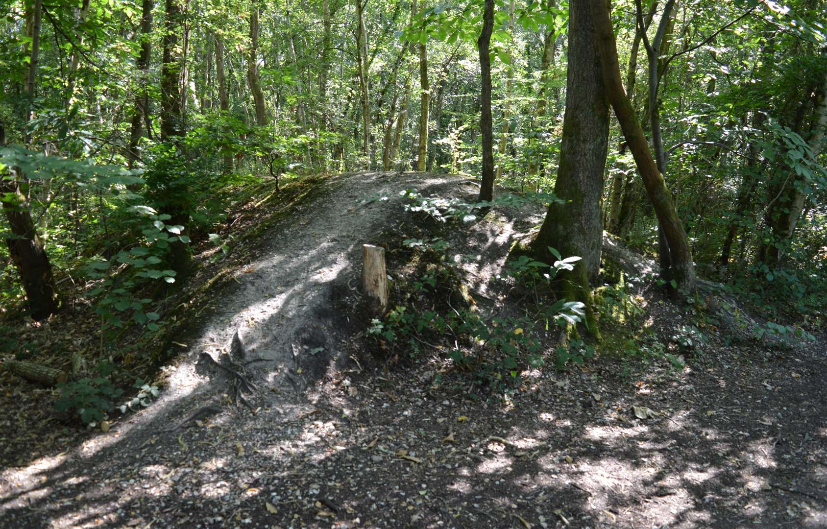
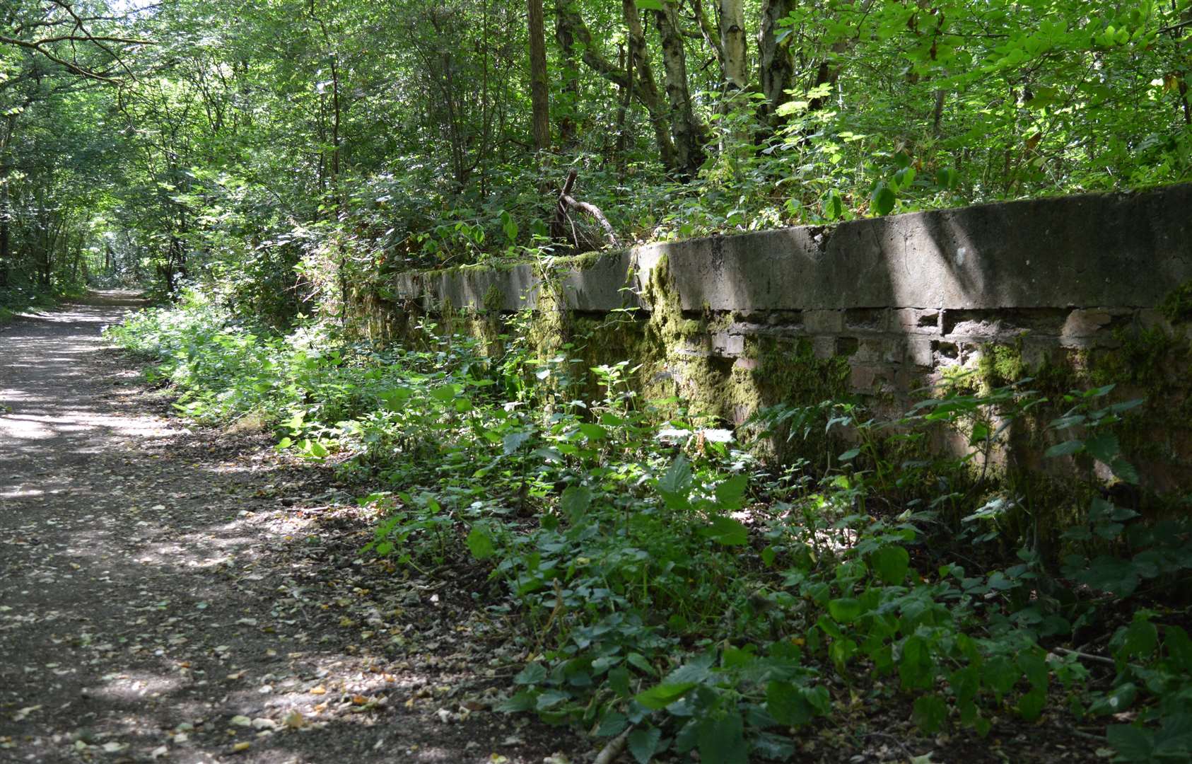
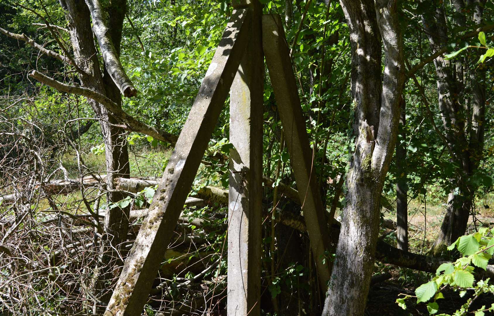
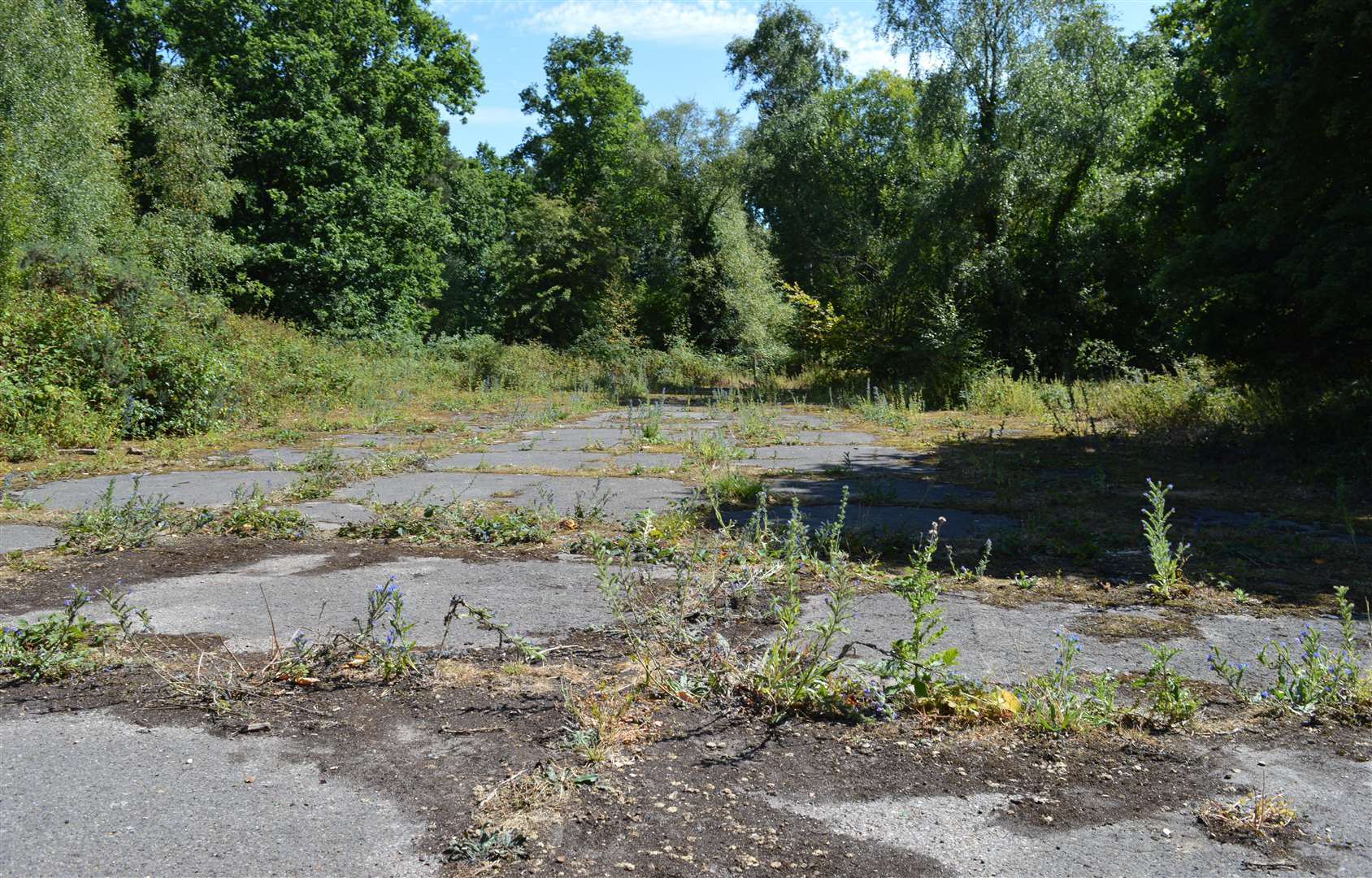
Her cottage backed on to Bowdown Woods, where remnants of munitions stores used in the Second World War and possibly later are still visible.
Close to her cottage was Grove Cottage, where General Eisenhower stayed around the time he gave his famous ‘eyes of the world are upon you’ speech to the first troops flying out to Normandy in June 1944.
Also located nearby is Bowdown House, which hosted King Haakon and other Norwegian royalty after they had fled the German invasion of their country in 1940.

Mrs Chaplain recalls seeing the physical remains of this bygone age.
She said: “When I walked my dog, all you could see was these concrete foundations these young chaps had built, and my cottage was right bang in the middle of them all.”
The foundations she mentions are listed on the map as temporary brick buildings.
They include a former sewage disposal works, medical inspection hut, sergeant’s mess, fuel compound, airmen’s showers and more.
The map also shows some of the accommodation and barracks built for the Women’s Auxiliary Air Force (WAAF), north of Bury’s Bank Road.
But they were apparently never used by this group and have been largely demolished since, according to The West Berkshire Historic Environment Record.
Remembering life near the base in later years, Mrs Chaplain added: “There was still a fence around it.
“I remember when the fence came down and we all beat the bounds.
“The Liberal MP, David Rendel, made a speech up there. I was there for that.
She also remembers the Greenham peace protesters, or ‘peace women’, encamped nearby.
The original wartime map (no 4818/44) is housed in the archives at West Berkshire Museum.
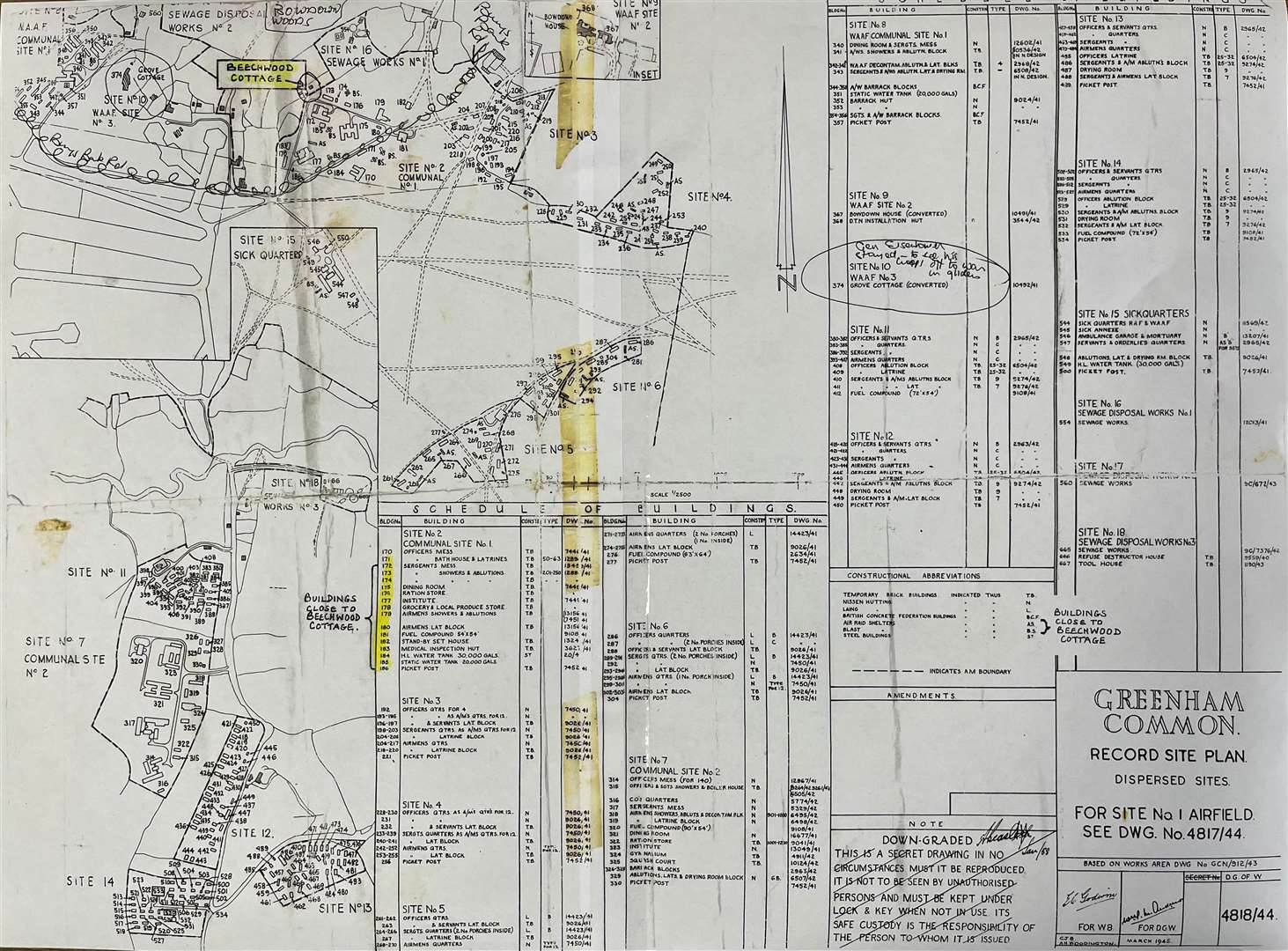
But a section of the map showing the layout at Bowdown Woods is missing.
The Air Ministry also produced a corresponding map (no 4817/44), understood to show more of the airfield itself.
The museum is currently in the process of cataloguing its collection of wartime maps, which could add to the overall understanding of this area’s lost military heritage.