
Great Shefford flood allevation plans submitted

THE Environment Agency has submitted formal plans for Great Shefford's long-awaited, £1.2m flood alleviation scheme.
A statement accompanying the application for planning permission states: "There is a high level of interest and support in the community for the scheme.
"The Great Shefford Flood Alleviation Association (GSFAA) was formed in 2018 by members of the community to raise funds with the aim of helping to co-ordinate, communicate and fundraise for a long-term solution."
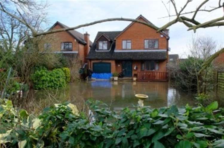
The application site is located on the east side of the A338 Wantage Road and the statement adds: "Great Shefford has a history of flooding from several sources (groundwater, surface water and fluvial), with properties within the village being flooded internally in both October 2000 and February 2014.
"The proposed development will reduce the risk of groundwater fed fluvial flooding in the area associated with the Great Shefford Stream, which flows north to south through Great Shefford along the A338.
"The project is being developed in close consultation with the local community.
"The proposed development will bring substantial positive effects to the residents of Great Shefford, motorists using the A338 through Great Shefford (which is a key diversion route for closures on the M4), and the wider economy."
A formal letter of support lodged with planners by a spokeswoman for the GSFAA, Linda Bowden, states: "I urge the planning officer to deal promptly with this long-awaited proposal to relieve the fear, which comes into the minds of all residents in the Wantage Road and nearby each springtime, when we have high levels of ground water.
"Many were affected by the flooding in 2014 which forced them to move out of their homes for a couple of years; others remained in their properties but lived with the effects of being flooded either in their homes or gardens for many months.
"As the title says, this is a flood alleviation proposal, not a permanent diversion of the winterbourne stream, which will continue to run.
"Only when water is excessive will the pipeline operate.
"Businesses both in the village and the surrounding area are affected by the necessary road closures when the A338 is flooded.
"This scheme is sympathetic to the surrounding area and, being largely underground, few will be aware of its presence."
The application, which outlines the project in detail, can be viewed by visiting the planning section of West Berkshire Council's website and using the reference 23/00663/FULMAJ.